
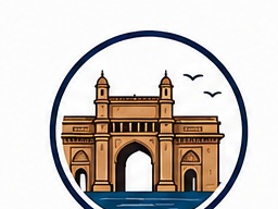
Mumbai
See what's happening
Browse topics · 31
Mumbai
Basic informationOpen ↗
| Field | Information | |---|---| | Official Name | Mumbai City district | | Common Name | Mumbai | | Native Name(s) | मुंबई (Marathi); Bombay (historical English name) | | Nicknames | City of Dreams; Financial Capital of India | | Motto | _Data not readily available for this location._ | | Geographic Level | District (urban district within Maharashtra) | | Country | India | | State/Province | Maharashtra | | Capital | Mumbai is the capital of Maharashtra; the district itself forms part of the city of Mumbai | | Government Type | District administration within the State of Maharashtra; urban local governance primarily through the Municipal Corporation of Greater Mumbai (for the broader city) | | Date Founded | The modern city developed under Portuguese and later British rule; the district as an administrative unit dates to the colonial and post-independence administrative system | | Time Zone | Indian Standard Time (IST), UTC+5:30 | | Latitude | Approximately 18.94° N | | Longitude | Approximately 72.84° E | | Elevation | Roughly 10–15 m above sea level in much of the built-up area | | Total Area | About 69 sq km (Mumbai City district) | | Population | About 3.1 million (2011 Census, Mumbai City district) | | Population Density | About 45,000 people per sq km | | ZIP/Postal Codes | Multiple PIN codes beginning largely with 4000xx | | Area Codes | +91-22 | | Official Languages | Marathi (state official); Hindi and English widely used | | Currency | Indian Rupee (INR) | | Demonym | Mumbaikar |
OverviewOpen ↗
Mumbai City district is the historic core of Mumbai, India’s largest metropolitan economy and one of the country’s most internationally recognized urban centers. It contains many of the institutions that shaped modern India’s commercial, legal, cultural, and political life, including major financial establishments, the Bombay High Court area, the Fort precinct, the old port zones, and landmark public architecture from the colonial era. Although the broader metropolis extends far beyond this district, Mumbai City remains the symbolic heart of the city.
The district matters far beyond its size. It sits on the Arabian Sea and helped connect western India to global maritime trade for centuries. During British rule, Bombay emerged as a major port and industrial center, particularly through cotton textiles and shipping. In modern India, Mumbai became the headquarters of finance, media, insurance, corporate services, and the Hindi film industry based mainly in the wider city. The district also includes some of the country’s most recognizable sites, such as the Chhatrapati Shivaji Maharaj Terminus area, Marine Drive, the Gateway of India precinct, and major museums and institutions.
Mumbai is known for extreme contrasts: dense informal settlements and some of India’s most expensive real estate; Victorian Gothic and Art Deco heritage next to modern high-rises; deeply local neighborhood life alongside global capital flows. The district’s public life is shaped by commuter movement, street food, markets, religious diversity, and a long tradition of migration from across India.
Interesting facts often noted about Mumbai include its island-city origins, its role as the capital of Maharashtra, its concentration of major financial institutions, and the fact that parts of south Mumbai hold UNESCO-recognized architectural ensembles. The district is small in land area but outsized in historical and economic influence.
HistoryOpen ↗
Long before colonial rule, the Mumbai region was inhabited by fishing communities, especially the Koli people, who are widely recognized as among the original inhabitants of the islands. The wider Konkan coast was shaped by successive regional powers, trade networks across the Arabian Sea, and religious and cultural exchange. Buddhism, Hinduism, Islam, and later Christianity all left visible marks on the region’s heritage.
The area that became Mumbai was originally a group of seven islands. These islands came under Portuguese control in the 16th century. In 1661, they were transferred to the British Crown as part of the dowry of Catherine of Braganza upon her marriage to Charles II of England. The islands were then leased to the English East India Company, which developed Bombay as a port and administrative center.
From the 18th to the 19th centuries, land reclamation projects physically reshaped the islands into a more unified urban landmass. Bombay grew rapidly due to its harbor, shipping, cotton trade, and links to the expanding railway network. The opening of the Suez Canal in 1869 strengthened its global maritime importance. The city became one of the British Empire’s principal ports in Asia.
Industrialization transformed Bombay in the 19th and early 20th centuries, especially through cotton textile mills. Merchants, industrialists, dockworkers, clerks, and migrants from Gujarat, Maharashtra, the Konkan, and many other regions contributed to its growth. The city also played a major role in India’s freedom movement, labor politics, and social reform movements.
After Indian independence in 1947, Bombay remained one of the country’s leading commercial centers. Political movements around language and state reorganization culminated in the creation of Maharashtra in 1960, with Bombay—later officially renamed Mumbai in 1995—as its capital. The late 20th century saw the decline of many textile mills, followed by the rise of finance, services, media, and real estate.
Modern Mumbai has also endured major crises, including communal tensions, the 1992–93 riots, the 1993 bomb blasts, the 2005 floods in the wider city, and the 2008 terrorist attacks. At the same time, the city has continued to reinvent itself through infrastructure projects, heritage preservation efforts, and the expansion of the wider metropolitan region.
GeographyOpen ↗
Mumbai City district occupies the southern part of the Mumbai peninsula on the west coast of India along the Arabian Sea. It is part of the Konkan coastal belt and lies within a highly urbanized environment shaped by historic island geography, reclaimed land, tidal edges, and harbor-oriented development. The district is bounded by the sea on multiple sides and transitions northward into Mumbai Suburban district.
Its physical geography is dominated less by wilderness and more by the interaction between land and sea. Natural inlets, coastal flats, low ridges, and reclaimed areas influenced the pattern of roads, railways, port facilities, and neighborhoods. The district includes parts of the city’s eastern waterfront facing Mumbai Harbor and western sea-facing areas along Back Bay and the open coast.
The terrain is generally low-lying, though not completely flat. Local ridges and elevated points influenced the siting of institutions, reservoirs, colonial defenses, and residential areas. Coastal exposure makes parts of the district vulnerable to storm surge, tidal flooding, and heavy monsoon runoff, especially where drainage is constrained.
Natural resources within the district itself are limited because it is intensely built up. Its greatest geographic asset has historically been its deep natural harbor and strategic maritime position. Geological features are associated with the Deccan Traps basalt formations common across much of western India, overlain in places by coastal and reclaimed soils.
The climate is tropical, with a pronounced monsoon season, high humidity for much of the year, and moderate seasonal temperature variation compared with inland India. The sea strongly shapes daily weather, wind patterns, and thermal comfort.
TopographyOpen ↗
Mumbai City district is a coastal, low-elevation urban district rather than a mountainous one. Its topography reflects the merging and reclamation of the original seven islands and includes shorelines, reclaimed flats, modest ridges, and built-up promontories.
- Highest point: The district includes Malabar Hill, one of the better-known elevated areas in south Mumbai, rising to roughly 50 m above sea level.
- Lowest point: Sea level along the Arabian Sea coast, Back Bay, and harbor edges.
- Hills and ridges: Malabar Hill and nearby rises are the district’s most prominent upland features. Smaller undulations influenced historic neighborhood layout.
- Coastal areas: Marine Drive, Colaba, Cuffe Parade, Nariman Point, and the eastern docklands occupy important waterfront zones.
- Flood-prone land: Low-lying reclaimed sections and drainage corridors can face waterlogging during intense monsoon rainfall and high tides.
- Plateaus and canyons: None of significance within the district’s urban footprint.
- Flood plains: There are no major river flood plains within the district comparable to inland districts, but tidal flooding and stormwater accumulation are significant practical topographic concerns.
Topography in Mumbai City is best understood as an urban coastal landscape where even small changes in elevation matter for drainage, land values, and historic development patterns.
Weather & climateOpen ↗
Mumbai City district has a tropical wet and dry climate under the Köppen classification Aw, strongly moderated by the Arabian Sea. Temperatures are warm throughout the year, humidity is often high, and the southwest monsoon dominates the annual rainfall cycle.
| Season | Typical Conditions | |---|---| | Winter (Dec–Feb) | Warm, relatively drier, often the most comfortable period | | Summer (Mar–May) | Hot, humid, increasingly oppressive before monsoon onset | | Monsoon (Jun–Sep) | Very heavy rainfall, cloudy skies, transport disruptions possible | | Post-monsoon (Oct–Nov) | Humid, warm, with gradual easing of rain |
Approximate climate patterns widely reported for Mumbai:
- Average daytime temperatures: often around 29–33°C for much of the year
- Cooler season lows: commonly around 16–22°C in winter mornings
- Annual rainfall: roughly 2,000 mm or more in the wider city, with most rain falling during the monsoon
- Snowfall: none
- Humidity: high for much of the year, especially from late spring through the monsoon and post-monsoon periods
Best time to visit: - November to February is generally considered the most comfortable period for walking, sightseeing, and outdoor activity.
Weather risks and natural hazards: - Intense monsoon downpours - Urban flooding and waterlogging - Coastal flooding during high tides combined with heavy rain - Occasional impacts from cyclonic systems over the Arabian Sea, though direct severe strikes are less frequent than on some other coasts
For everyday life, the monsoon is the defining weather event in Mumbai: it cools the city, replenishes water supplies, and also places pressure on drainage, transport, and infrastructure.
PopulationOpen ↗
Mumbai City district had a population of about 3.1 million in the 2011 Census of India. It is one of the most densely populated districts in the country, though the broader Mumbai urban agglomeration is much larger and includes populations in Mumbai Suburban district and neighboring metropolitan areas.
Key demographic features commonly associated with the district and the wider city include:
- High density: The district has extremely intense residential and commercial land use.
- Migration: Mumbai has long attracted migrants from across Maharashtra and from states such as Uttar Pradesh, Gujarat, Rajasthan, Bihar, Karnataka, Tamil Nadu, and others.
- Age structure: A large working-age population is typical, reflecting the city’s role as an employment center.
- Gender balance: Historically, some parts of Mumbai showed male-skewed migration patterns, though gender ratios vary by ward and neighborhood.
- Literacy and education: Literacy levels are generally high by national standards in the urban core.
Languages spoken: - Marathi is the principal state language. - Hindi is widely spoken in daily commerce and migration-linked communities. - English is important in education, administration, law, finance, and corporate life. - Gujarati, Urdu, Tamil, and several other Indian languages are also widely heard.
Religious composition: Mumbai is religiously diverse. Hinduism is the largest religion, with substantial Muslim, Jain, Christian, Buddhist, Sikh, Parsi, and Jewish communities contributing to the district’s historic identity.
Socioeconomic profile: - The district includes both high-income enclaves and lower-income, highly congested housing areas. - Employment is concentrated in services, trade, government, transport, hospitality, finance, and informal work. - Educational attainment varies sharply by locality.
Detailed current breakdowns for age groups, income, and employment at the district level should be checked against the latest official census releases and state statistical publications.
GovernmentOpen ↗
Mumbai City district is administered as a district of Maharashtra, while the broader urban area is governed through a combination of state agencies, district administration, and municipal institutions. The key civic body for most of Mumbai is the Municipal Corporation of Greater Mumbai (MCGM/BMC), one of India’s largest urban local bodies.
Administrative structure: - District administration: Led by a District Collector or equivalent state-appointed officer for district-level administration, revenue, and coordination. - Municipal governance: The Brihanmumbai Municipal Corporation manages local urban services across the larger city, including roads, public health, waste management, licensing, and water-related functions. - State government presence: Because Mumbai is the capital of Maharashtra, many major state departments and institutions are headquartered here. - Police and law enforcement: Mumbai Police functions under the state home department.
Political representation: - The district forms part of constituencies for the Maharashtra Legislative Assembly and the Lok Sabha. - Representation boundaries can change through delimitation, so current constituency maps should be checked with the Election Commission of India.
Government type in practice: - Urban local self-government under Indian constitutional provisions, combined with strong state-level oversight and specialized metropolitan agencies.
Public services typically managed through government bodies: - Water supply and sewerage - Public health facilities - Primary education through municipal schools - Roads and street lighting - Building permissions and urban planning functions - Solid waste collection - Public markets, parks, and crematoria/cemeteries
Mumbai’s governance is often discussed as complex because multiple authorities share responsibility, including the municipal corporation, state agencies, transport undertakings, housing boards, port authorities, and rail bodies.
EconomyOpen ↗
Mumbai City district sits at the center of India’s most influential metropolitan economy, though district-specific GDP figures are not commonly reported in a simple standalone form. The wider Mumbai economy is nationally important in finance, banking, insurance, trade, media, professional services, real estate, logistics, and government administration.
Historically, south Mumbai and the old island city developed around the port, mercantile houses, cotton trade, shipping, and textile mills. Over time, many traditional industrial functions moved or declined, while corporate headquarters, financial institutions, luxury retail, hospitality, legal services, and cultural industries became more prominent. The district includes some of India’s most expensive commercial land and office zones.
Economic strengths: - Headquarters and back-office concentration for major Indian and multinational firms - Strong financial ecosystem including banks, stock market institutions, and insurers in the wider city - Heritage tourism and business travel - Strategic coastal and port-related geography - Dense labor market and deep service-sector specialization
Major employers and institutions in or closely tied to the district: - Government offices of Maharashtra - Municipal Corporation of Greater Mumbai - Financial institutions and corporate headquarters in south and central business districts - Port, customs, shipping, hospitality, education, and healthcare institutions
Cost of living: - Mumbai is widely recognized as one of India’s most expensive housing and commercial real-estate markets. - Daily living costs vary greatly by neighborhood and housing type, but affordability is a major public issue.
Future development themes: - Redevelopment of aging commercial and residential areas - Heritage conservation alongside infrastructure modernization - Coastal and transport-linked urban renewal - Resilience investments for flooding, drainage, and mobility
District-level median income figures are not consistently published in a simple official format; ward and metropolitan data are often more useful than district-wide averages.
IndustriesOpen ↗
- Finance and Banking — Mumbai is India’s leading financial center, with major banks, capital-market institutions, insurance firms, and investment offices concentrated in the wider city, especially in the historic commercial core.
- Government and Public Administration — As the capital of Maharashtra, the district hosts major state offices, courts, and administrative institutions.
- Port, Shipping, and Logistics — The harbor and dock areas have long supported maritime trade, customs activity, warehousing, and related services.
- Real Estate and Construction — Redevelopment, commercial towers, luxury housing, and infrastructure-led urban change are major economic drivers.
- Tourism and Hospitality — Heritage architecture, waterfront attractions, business travel, and cultural institutions sustain hotels, restaurants, and tourism services.
- Media and Entertainment — While the film industry is spread across the wider city, Mumbai’s central districts remain important for media offices, advertising, publishing, and cultural institutions.
- Retail and Wholesale Trade — Traditional markets, jewelry, textiles, consumer goods, and high-end retail all play important roles.
- Legal and Professional Services — Law firms, consultancies, accounting, and corporate services cluster near commercial and institutional districts.
- Healthcare — Large hospitals, specialty clinics, and medical education institutions make healthcare a significant employer.
- Education and Research — Universities, colleges, libraries, and research institutions support employment and knowledge-intensive activity.
AgricultureOpen ↗
Agriculture is not a major land use within Mumbai City district because it is almost entirely urbanized.
- Crops: Negligible within the district’s built-up area.
- Livestock: Limited to small-scale or institutional activity rather than mainstream agriculture.
- Fisheries: Traditional fishing communities, especially Koli communities in the wider Mumbai region, remain historically important. Coastal fishing and fish markets are part of the city’s food economy, though large-scale fisheries activity is not concentrated in the district alone.
- Forestry: No significant forestry sector within the district.
- Food production: The district depends heavily on supply chains from the rest of Maharashtra, other Indian states, and imports through regional wholesale markets and transport networks.
- Organic farming: Very limited, mainly confined to niche urban gardening or small community initiatives rather than significant commercial production.
In practical terms, Mumbai City is a consumer and distribution center rather than an agricultural producer.
HousingOpen ↗
Housing in Mumbai City district is defined by scarcity of land, very high demand, aging building stock in some precincts, premium waterfront real estate, dense apartment living, and longstanding affordability pressures. The district contains some of India’s most expensive residential addresses as well as overcrowded and lower-income housing areas.
Market characteristics: - Extremely high land values, especially in south Mumbai. - A mix of heritage buildings, old rent-controlled properties, cooperative housing societies, chawls, modern towers, and luxury apartments. - Limited supply of new large-scale land parcels because the district is already intensely built out.
Common housing types: - Apartments in mid-rise and high-rise buildings - Older colonial-era and early 20th-century buildings - Cooperative society flats - Single-family bungalows in very limited elite pockets - Redevelopment-driven residential towers replacing older structures in some areas
Rental market: - Rents are generally high relative to most Indian cities. - Smaller units and older buildings may offer relatively lower entry points, but affordability remains difficult for many workers.
Home prices: - Prices vary dramatically by neighborhood, building age, sea view, transit access, and redevelopment potential. - Premium areas such as Malabar Hill, Cuffe Parade, Nariman Point-adjacent areas, and parts of Colaba rank among the most expensive.
Housing challenges: - Affordability and overcrowding - Building maintenance and redevelopment disputes - Tension between heritage preservation and densification - Pressure on infrastructure in highly dense neighborhoods
For current price ranges, the most reliable sources are state registration data, housing market reports, and active property listings, as official district-wide averages change frequently.
NeighborhoodsOpen ↗
As a district within the larger city of Mumbai, Mumbai City contains many of the historic and civic neighborhoods most associated with the city’s identity.
- Fort — The old colonial business and institutional quarter, known for heritage architecture, offices, courts, and museums.
- Colaba — A southern waterfront area known for tourism, the Gateway of India precinct, cafes, markets, and naval presence.
- Cuffe Parade — A prominent upscale residential and commercial area at the southern tip of the city.
- Nariman Point — A major central business district built on reclaimed land, associated with offices and sea-facing promenades.
- Marine Drive / Churchgate — Famous for its curved boulevard, Art Deco buildings, and access to business, education, and sports institutions.
- Malabar Hill — One of Mumbai’s most prestigious residential areas, also home to official residences and Hanging Gardens nearby.
- Girgaon — A dense, historic Marathi-speaking neighborhood known for cultural traditions and proximity to Girgaum Chowpatty.
- Byculla — A historically diverse area with institutions, markets, transport links, and older residential fabric.
- Mazgaon — One of the old island settlements, with dock-related history and mixed residential-industrial character.
- Parel — Historically tied to textile mills; in the wider central city it became a major redevelopment and commercial zone.
- Worli — A significant seafront area blending older settlements, business spaces, and modern high-rise development.
- Bhuleshwar / Kalbadevi — Dense traditional trading neighborhoods known for markets, temples, and mercantile communities.
Neighborhood boundaries may vary in common usage, postal identity, and administrative mapping.
TransportationOpen ↗
Mumbai City district is one of India’s most connected urban areas, though congestion is a defining feature. It is served by suburban rail, major roads, city buses, taxis, ferries, and regional and national transport links.
Roads and highways: - Dense arterial road network linking south Mumbai to central and suburban areas. - Important corridors connect to the Eastern Freeway, coastal routes, and citywide north-south links. - Traffic congestion is common, especially during peak hours and monsoon disruptions.
Rail: - Mumbai’s suburban railway system is the backbone of metropolitan mobility. - Key stations in or serving the district include Chhatrapati Shivaji Maharaj Terminus (CSMT), Churchgate, Mumbai Central, Byculla, and others. - Long-distance rail services connect Mumbai to the rest of India.
Metro and urban transit: - Metro expansion in Mumbai is ongoing, though the historic southern core has traditionally depended more on suburban rail, buses, and taxis than on metro coverage. - The wider city’s transit integration is gradually improving.
Buses: - BEST (Brihanmumbai Electric Supply and Transport) operates extensive bus services connecting neighborhoods and interchanges across Mumbai.
Airports: - The district does not contain the city’s main airport, but it is served by Chhatrapati Shivaji Maharaj International Airport in the suburban district.
Ports and ferries: - Mumbai Port and nearby waterfront facilities remain strategically important. - Ferry services connect to destinations such as Elephanta Island and across parts of the harbor region.
Taxis and rideshare: - Black-and-yellow taxis are a longstanding part of city mobility. - App-based ride services are widely used.
Walking and cycling: - Walkability varies sharply. Some older neighborhoods are highly walkable for short trips, but narrow footpaths, traffic, and weather can be challenges. - Dedicated cycling infrastructure is limited compared with some global cities.
EV charging: - EV charging infrastructure is expanding across Mumbai, though availability is uneven and best checked on current provider maps.
Mumbai’s transport strength lies in network density and frequency rather than ease or comfort; the district functions because of constant, high-volume movement.
InfrastructureOpen ↗
Mumbai City district has relatively advanced urban infrastructure by Indian standards, but its age, density, coastal exposure, and huge daily commuter load create persistent strain.
Electricity: - Power supply is generally robust in the core city, supported by major utility providers. - Outages can occur, but reliability in much of the district is comparatively strong for India.
Water supply: - Water is supplied through the larger Mumbai municipal system, drawing on reservoirs outside the district. - Seasonal pressure on supply and distribution management remains important, especially in summer and during infrastructure failures.
Sewer and drainage: - Sewerage exists across much of the built-up district, but stormwater drainage remains a major challenge during extreme monsoon events. - Flood mitigation and pumping upgrades are recurring public priorities.
Solid waste: - Municipal collection is widespread, though waste management at city scale remains complex due to population density and consumption levels.
Internet and broadband: - The district has broad access to fiber broadband, cable internet, and mobile data services. - Commercial areas usually have strong connectivity, though service quality varies by building and provider.
Cellular service: - Coverage is generally extensive across all major telecom operators.
Public health infrastructure: - The district and broader city are served by municipal, state, charitable, and private hospitals and clinics.
Urban resilience issues: - Monsoon flooding - Coastal vulnerability - Aging pipes, roads, and buildings in older precincts - Heavy load on transport and utilities from daily floating population
In short, infrastructure in Mumbai City is dense and functionally sophisticated, but under constant pressure from geography, scale, and age.
EducationOpen ↗
Mumbai City district and the wider city are among India’s most important educational centers, with major universities, colleges, schools, libraries, and professional institutions.
Major institutions associated with the district or central Mumbai include: - University of Mumbai — One of India’s oldest and most influential universities, with historic facilities in south Mumbai and a broad network of affiliated colleges. - St. Xavier’s College, Mumbai — A highly regarded arts and science college with a long academic tradition. - Elphinstone College — One of the city’s historic colleges, important in the educational history of western India. - Institute of Chemical Technology (ICT), Mumbai — A leading institution in chemical engineering, technology, and scientific research, located in central Mumbai. - J.J. School of Art — A major art institution with deep historical significance. - Siddharth College — Known for its association with educational access and social reform traditions. - The Cathedral and John Connon School — One of Mumbai’s best-known schools. - St. Xavier’s High School / related Jesuit educational institutions — Part of the city’s longstanding school network. - Asiatic Society of Mumbai Library — A major historic library and research resource. - David Sassoon Library and Reading Room — An important heritage library in the Fort area.
Educational profile: - The district has dense access to schools, colleges, coaching centers, and professional education. - English-medium education is widespread, alongside Marathi, Hindi, Urdu, and other linguistic traditions. - Municipal schools serve many residents, while aided and private institutions play a major role.
For families and researchers, Mumbai’s strength lies in the range of institutions—from municipal primary schools to elite colleges and specialized professional centers.
Local organizationsOpen ↗
Local Organizations
Mumbai has a dense network of civic, charitable, business, cultural, and neighbourhood organizations. A full directory would be very long; the list below highlights widely known institutions and types of groups residents commonly engage with.
Business and trade bodies - Bombay Chamber of Commerce and Industry — one of India’s oldest business chambers, based in Mumbai. - IMC Chamber of Commerce and Industry — major business association serving Mumbai and wider India. - Maharashtra Chamber of Commerce, Industry and Agriculture — statewide body with strong Mumbai relevance. - ASSOCHAM and CII regional offices — national industry bodies active in the city.
Community and civic organizations - Rotary clubs across Mumbai — active in health, education, and community service. - Lions Clubs in Mumbai — support vision care, service projects, and local charity work. - NSS and NCC units at colleges — student volunteering, public service, and youth development. - Resident welfare and housing society associations — especially important in neighbourhood-level problem solving.
Major nonprofits and public-interest groups - The Akanksha Foundation — education-focused nonprofit with Mumbai roots. - Pratham — major education nonprofit active in Mumbai and beyond. - Teach For India — headquartered in Mumbai; works on educational equity. - SNEHA (Society for Nutrition, Education and Health Action) — public health and community work in vulnerable settlements. - United Way Mumbai — philanthropic and volunteer coordination platform. - CRY (Child Rights and You) — national child-rights organization with strong Mumbai presence. - Yuva and other housing-rights/community-development groups — active in urban inclusion issues.
Culture, heritage, and public life - Asiatic Society of Mumbai — longstanding learned institution and library. - NGMA Mumbai and museum support societies — arts and heritage engagement. - Kala Ghoda Association — associated with the well-known arts festival district. - Neighbourhood heritage groups in areas such as Fort, Bandra, and Dadar.
Faith-based and service networks - Mumbai’s temples, mosques, churches, gurdwaras, and trusts often operate: - community kitchens - educational aid programs - health camps - shelter and relief activities
How people usually connect locally - Municipal ward meetings and public consultations - College festivals and volunteer drives - Housing society groups - Professional networks in finance, film, media, law, technology, and healthcare - Cause-based campaigns around coastal ecology, transport, housing, waste, and heritage
Education statisticsOpen ↗
Education Statistics
Mumbai is one of India’s most important education centers, with a large mix of municipal schools, state-board schools, central schools, private schools, colleges, technical institutes, and research universities.
Overview - The district/city has high literacy by Indian standards, with Mumbai city and suburban areas historically recording literacy rates above national averages in Census reporting. - Mumbai is home to some of India’s best-known higher education institutions, including: - University of Mumbai - Indian Institute of Technology Bombay (in Powai, in the wider Mumbai metropolitan area) - Tata Institute of Social Sciences - Institute of Chemical Technology - SNDT Women’s University - St. Xavier’s College - English, Marathi, Hindi, and other languages are commonly used across the school and college system depending on board and institution.
Schooling landscape - Brihanmumbai Municipal Corporation (BMC) runs municipal schools. - Major boards represented include: - Maharashtra State Board - CBSE - ICSE/ISC - International curricula in selected private schools - Mumbai has a large concentration of junior colleges and degree colleges compared with most Indian districts.
Higher education and rankings - IIT Bombay is regularly placed among India’s top engineering institutions and appears in major global university rankings. - University of Mumbai is one of India’s oldest universities and affiliates many colleges across the metropolitan region. - TISS is especially well regarded in social sciences, public policy, and social work. - ICT Mumbai is widely respected in chemical engineering, pharmacy, and applied sciences.
Literacy and performance - Census-based literacy figures are available for Mumbai district areas, but exact figures vary depending on whether one refers to Mumbai City district, Mumbai Suburban district, or the broader municipal corporation area. - Graduation rates, school pass percentages, and institution-specific rankings are published periodically by state boards, universities, and national ranking systems.
Notes on data - India does not always publish a single simple district-level dashboard for all education outcomes in the same format used in some other countries. - For the most dependable current figures, consult: - Census of India - Ministry of Education, Government of India - AISHE (All India Survey on Higher Education) - NIRF rankings - official university and school board results portals
Quick summary table | Topic | Mumbai context | |---|---| | Literacy | Above national average in census reporting | | School systems | State board, CBSE, ICSE, international | | Municipal schools | Extensive BMC network | | Major university hub | Yes | | Globally recognized institutions | IIT Bombay and others | | Student migration destination | Strongly yes |
_Data not readily available for this location._
Public utilitiesOpen ↗
Public Utilities
Mumbai’s utilities are managed through a mix of municipal bodies, state agencies, and licensed providers.
Electricity - Brihanmumbai Electric Supply and Transport (BEST) supplies electricity in parts of Mumbai. - Adani Electricity Mumbai Limited supplies electricity in large parts of suburban Mumbai. - Tata Power is also a significant electricity utility and supplier in the region. - Power reliability is generally better than in many Indian cities, though monsoon weather and local faults can still cause outages.
Water supply - Brihanmumbai Municipal Corporation (BMC) is responsible for municipal water supply. - Mumbai depends on a network of lakes and reservoirs outside the core city, including well-known sources such as Tulsi, Vihar, Bhatsa, Upper Vaitarna, Middle Vaitarna, Modak Sagar, and Tansa systems. - Water distribution can be uneven, and some neighbourhoods rely on storage tanks, pumps, or supplementary arrangements.
Sewerage and drainage - BMC manages sewerage and much of the stormwater drainage system. - Drainage is a major public issue because intense monsoon rainfall can lead to flooding, especially in low-lying areas. - The city has implemented and planned multiple stormwater improvement and pumping projects over time.
Solid waste management - BMC oversees municipal solid waste collection and disposal. - Segregation, recycling, and landfill pressure are continuing urban challenges. - Informal recycling networks play a significant role alongside formal waste systems.
Gas - Piped gas and LPG services are used across the city depending on locality and housing type. - PNG/CNG networks in the wider metropolitan area are associated with providers such as Mahanagar Gas.
Public transport as a utility-like service - BEST operates the city bus system. - Mumbai Suburban Railway is operated by Indian Railways zones and is essential to daily life. - Mumbai Metro and Monorail supplement mobility in selected corridors.
Telecom and internet - Major national providers operate in Mumbai, including large mobile and broadband companies. - High-speed internet is widely available in commercial and middle- to upper-income residential areas, though service quality varies.
Common resident concerns - Monsoon flooding - Water leakage and pressure variation - Building-level infrastructure maintenance - Waste segregation compliance - Traffic disruption during utility works
Emergency and service contacts - Utility complaints are commonly handled through: - official BMC channels - BEST utility services - electricity provider customer portals - ward offices and local complaint systems
SafetyOpen ↗
Safety
Mumbai is often regarded as one of India’s more functional large cities for daily movement, but like any megacity it has a mixed safety picture shaped by crowding, traffic, weather, and neighbourhood differences.
General safety overview - Crowded public spaces, transport hubs, and markets require normal urban caution. - Petty theft, scams, and opportunistic crime can occur, especially in tourist-heavy or congested areas. - Women, students, and commuters often use busy public transport networks daily; perceptions of safety vary by time, route, and neighbourhood. - The biggest practical risks for many residents are often: - road accidents - flooding during monsoon - building safety issues in older structures - crowding in transit systems
Emergency numbers in India - 112 — national emergency response - 100 — police (legacy emergency number still widely recognized) - 101 — fire - 102 / 108 — ambulance and emergency medical services in many contexts
Policing and public order - Mumbai Police is the principal law-enforcement agency for the city. - Police presence is significant in business districts, transport nodes, and during major festivals and public events. - Security checks are common at some stations, civic buildings, malls, and event venues.
Visitor safety tips - Use registered taxis, app-based cabs, or trusted transport where possible. - In local trains, stay alert during rush hours and watch belongings closely. - During monsoon season: - monitor weather alerts - avoid waterlogged streets - allow extra travel time - be cautious near the seafront during high tide - At beaches and promenades, follow local warnings about tides and rough seas. - Carry digital and physical copies of important identification when traveling.
Women’s safety - Mumbai is often described as comparatively active late into the evening, but standard precautions remain important. - Women-only train compartments and designated transit arrangements exist in some systems. - Well-lit routes and trusted transportation remain advisable at night.
Disaster and seasonal risks - Monsoon flooding is the city’s most widely known recurring hazard. - Coastal exposure and heavy rainfall can disrupt transport, housing, and utilities. - Heat, humidity, and waterborne disease risks can also rise seasonally.
Public health and medical access - Mumbai has many major hospitals, including public and private tertiary-care centers. - In emergencies, traffic can slow movement significantly, so location planning matters.
Bottom line - For most residents and visitors, Mumbai is manageable with normal big-city caution. - The most important safety habits are transport awareness, weather awareness, and secure handling of valuables.
EnvironmentOpen ↗
Environment
Mumbai’s environment is defined by its coastal setting, tropical monsoon climate, urban density, wetlands, creeks, and protected green areas.
Natural setting - Located on India’s west coast along the Arabian Sea. - Historically developed from a group of islands that were gradually connected through land reclamation and urban growth. - Includes beaches, mangroves, creeks, rocky coasts, and hill/forest pockets in the larger metropolitan area.
Climate - Tropical wet-and-dry / monsoon-influenced climate. - Main seasons: - hot and humid pre-monsoon period - intense southwest monsoon rains - milder dry season - Heavy rainfall is central to the city’s ecology and also one of its biggest infrastructure stresses.
Air quality - Air quality varies by season and locality. - Traffic, construction dust, industrial activity, and regional weather patterns affect pollution levels. - Winter and stagnant-air periods can worsen particulate pollution. - Current readings are best checked through official or recognized real-time air quality platforms.
Water and coastal environment - Mumbai depends on reservoir-based freshwater systems outside the dense urban core. - Coastal waters and urban rivers/creeks face pressure from sewage, runoff, plastic waste, and industrial pollution. - Flood management and drainage remain central environmental policy issues.
Protected and notable natural areas - Sanjay Gandhi National Park — a major protected green space in the metropolitan area, important for biodiversity and urban recreation. - Aarey — ecologically significant green area, though also contested in planning debates. - Mangrove belts and wetlands around creeks and coastal margins provide storm buffering and habitat. - Marine and intertidal stretches support birdlife and local ecological systems.
Biodiversity - Despite urbanization, the Mumbai region supports: - mangrove ecosystems - birdlife in wetlands and coastlines - urban wildlife in protected green spaces - marine intertidal life along parts of the shore
Sustainability and waste - Recycling and waste segregation are active public issues. - Civil society campaigns often focus on: - beach cleanups - plastic reduction - mangrove protection - lake and river awareness - tree conservation
Major environmental challenges - Flooding and drainage pressure - Loss of wetlands and open space - Coastal pollution - Air pollution from transport and construction - Heat and urban stress linked to dense built form
Environmental outlook Mumbai’s future resilience depends heavily on: - drainage upgrades - wetland and mangrove protection - stronger waste management systems - cleaner transport and air quality action - climate adaptation for sea-level and rainfall extremes
Future developmentOpen ↗
Future Development
Mumbai is in a near-constant state of redevelopment, infrastructure expansion, and policy debate. Because the city is densely built and economically central to India, future development is shaped by transport, housing, coastal resilience, and business investment.
Major infrastructure themes - Metro expansion — one of the city’s most significant current transformation projects, intended to improve east-west and north-south connectivity. - Road and sea-link projects — major highway, bridge, and coastal mobility works continue to reshape travel patterns. - Mumbai Coastal Road and related transport interventions have been among the most prominent projects in recent years. - Suburban railway modernization remains critical given the scale of daily commuting.
Regional transport integration - Mumbai is increasingly planned as part of the larger Mumbai Metropolitan Region (MMR). - Connectivity projects link Mumbai more closely with Navi Mumbai, Thane, and other MMR nodes. - The development of Navi Mumbai International Airport is expected to affect regional passenger and logistics patterns.
Housing and urban redevelopment - Redevelopment of old buildings, cessed properties, and former mill or industrial lands continues. - Slum rehabilitation and affordable housing remain major policy goals, though implementation is complex and often contested. - Coastal and high-value land development is often politically and socially sensitive.
Climate and resilience planning - Flood mitigation, pumping stations, drainage upgrades, and coastal protection remain important long-term priorities. - Urban planning increasingly has to account for: - extreme rainfall - sea-level risk - wetland preservation - heat and livability
Economic future - Mumbai is expected to remain a leading Indian center for: - finance - media and entertainment - trade and logistics - technology and startups - professional services - Redevelopment districts and transit-linked corridors may shift where offices, housing, and commercial activity concentrate.
Civic questions shaping the future - How to balance growth with ecological protection - Whether transit can keep up with population and job concentration - How to preserve heritage while upgrading aging infrastructure - How to expand affordable housing in a high-cost city
Likely direction Mumbai’s future is likely to be defined by denser transit-linked growth, regional integration, redevelopment of older urban fabric, and stronger climate adaptation measures.
DemographicsOpen ↗
Demographics
Mumbai is one of India’s most diverse urban districts, with substantial migration from across Maharashtra and the rest of India. Exact shares vary depending on whether one refers to Mumbai City district, Mumbai Suburban district, or the wider municipal area/metropolitan region.
Demographic profile | Category | Summary | |---|---| | Population character | Extremely dense, highly urban, migration-driven | | Major languages | Marathi, Hindi, English, Gujarati, Urdu, and many others | | Religion | Hindu majority with large Muslim, Christian, Jain, Buddhist, Sikh, and other communities | | Age profile | Large working-age population | | Household structure | Mix of nuclear families, joint families, migrants, and single working residents | | Settlement pattern | High-rise districts, chawls, older neighbourhoods, informal settlements, suburban housing colonies |
Ethnic and cultural composition - Mumbai’s identity is shaped less by a single ethnic category than by linguistic, regional, and occupational diversity. - Significant communities have roots in: - Maharashtra - Gujarat - Uttar Pradesh - Rajasthan - South India - Sindhi, Parsi, Konkani, and other long-established urban groups
Religion - Hinduism is the largest religion. - Islam has a major presence across many neighbourhoods. - Christianity has historic and contemporary importance, especially in parts of the old island city and suburbs. - Jain, Buddhist, Sikh, Jewish, and Zoroastrian/Parsi communities have also contributed significantly to the city’s public life.
Language distribution - Marathi is the state language and a major daily language. - Hindi is widely spoken across the city. - English is important in education, business, law, media, and administration. - Gujarati and Urdu are also prominent in many communities.
Age groups and migration - Mumbai attracts students, workers, professionals, entrepreneurs, and creative talent from across India. - The city has a strong concentration of people in working ages due to employment opportunities.
Data note Detailed percentages differ by census unit and year.
_Data not readily available for this location._
Interesting factsOpen ↗
Interesting Facts
- Mumbai was historically formed from seven islands that were gradually connected over time.
- The city was officially called Bombay until the name Mumbai became the standard official name in the 1990s.
- Mumbai is the capital of Maharashtra.
- It is widely regarded as India’s financial capital.
- The Bombay Stock Exchange is one of Asia’s oldest stock exchanges.
- The Reserve Bank of India has its headquarters in Mumbai.
- The city is a major center of the Indian film industry, including Bollywood.
- Chhatrapati Shivaji Maharaj Terminus is a UNESCO World Heritage Site.
- The Victorian Gothic and Art Deco Ensembles of Mumbai are recognized by UNESCO.
- The Gateway of India is one of the country’s best-known landmarks.
- Mumbai’s local train system is among the busiest suburban rail networks in the world.
- The city sits on the Arabian Sea, giving it a strong maritime identity.
- Mumbai’s monsoon season is one of the defining features of city life.
- Marine Drive is one of India’s most iconic urban promenades.
- The city has long been a magnet for migrants from across India.
- Dabbawalas of Mumbai are internationally known for their tiffin delivery system.
- Mumbai is home to major institutions in finance, media, law, medicine, engineering, and the arts.
- The city contains striking contrasts between global corporate districts and some of the world’s most crowded neighbourhoods.
- Sanjay Gandhi National Park gives the metropolitan region an unusual amount of protected forest for such a large city.
- Mumbai’s food culture blends Maharashtrian, Gujarati, Irani, coastal, street-food, and pan-Indian influences.
FAQOpen ↗
FAQ
Q: Where is Mumbai located? A: Mumbai is on the west coast of India along the Arabian Sea, in the state of Maharashtra.
Q: Is Mumbai a city or a district? A: It is both a city and part of two main administrative districts: Mumbai City and Mumbai Suburban, within the larger municipal corporation area.
Q: What is Mumbai famous for? A: It is known for finance, Bollywood, the port, colonial-era architecture, local trains, and its role as a major gateway to India.
Q: What language is spoken in Mumbai? A: Marathi is the state language, while Hindi and English are also widely used. Gujarati, Urdu, and many other languages are common too.
Q: What is the best time to visit Mumbai? A: Many visitors prefer the cooler, drier months roughly from November to February. The monsoon is dramatic but can disrupt travel.
Q: Does Mumbai have a beach culture? A: Yes, but the city’s seafront culture is often more about promenades, sunsets, snacks, and public gathering than swimming.
Q: Is Mumbai expensive? A: Yes, especially housing and some commercial areas. Costs vary widely by neighbourhood and lifestyle.
Q: How do people get around Mumbai? A: By suburban trains, buses, metro, taxis, auto-rickshaws in many suburbs, app cabs, ferries in some cases, and private vehicles.
Q: Is Mumbai safe for tourists? A: Generally yes with normal urban precautions, especially around valuables, traffic, and monsoon conditions.
Q: What is the emergency number in Mumbai? A: The all-India emergency number is 112.
Q: Why is Mumbai important to India’s economy? A: It hosts major banks, financial institutions, stock exchanges, corporate headquarters, media companies, and port-linked trade activity.
Q: What are Mumbai’s most famous landmarks? A: Gateway of India, Marine Drive, Chhatrapati Shivaji Maharaj Terminus, Haji Ali, Elephanta Caves, and the Art Deco seafront.
Q: What is the weather like in Mumbai? A: Warm to hot for much of the year, humid, with very heavy rain during the monsoon.
Q: Is Mumbai part of a larger metro region? A: Yes, it is the core of the Mumbai Metropolitan Region, linked with Thane, Navi Mumbai, and surrounding areas.
Q: Are there good universities in Mumbai? A: Yes. Mumbai has several respected institutions, including University of Mumbai, IIT Bombay, TISS, and ICT.
Q: What food should a visitor try in Mumbai? A: Popular choices include vada pav, pav bhaji, bhel puri, Bombay sandwich, seafood, and Irani café dishes.
Q: What is the significance of the dabbawalas? A: They are known for an efficient lunchbox delivery system that has received international attention.
Q: Does Mumbai have green space? A: Yes, though not in equal measure everywhere. Major green assets include Sanjay Gandhi National Park, gardens, mangroves, and the Aarey area.
Q: What are the biggest challenges facing Mumbai? A: Housing affordability, congestion, flooding, air quality, infrastructure strain, and balancing growth with ecology.
Q: Why do some people still call it Bombay? A: Bombay was the older official English name, and it remains in historical, institutional, and colloquial use in some contexts.
ImagesOpen ↗
Mumbai skyline from Marine Drive Mumbai downtown Nariman Point and business district Chhatrapati Shivaji Maharaj Terminus historic architecture Mumbai Gateway of India Mumbai waterfront Sanjay Gandhi National Park Mumbai landscape Mumbai beaches and promenade sunset Mumbai street food vada pav and pav bhaji Ganesh Chaturthi festival Mumbai procession Bandra Worli Sea Link aerial view Mumbai monsoon cityscape aerial
VideosOpen ↗
Mumbai travel guide video Mumbai walking tour Colaba Fort Marine Drive Mumbai drone footage skyline coast sea link History of Mumbai documentary Mumbai local train experience video Mumbai street food tour video Mumbai monsoon news coverage Ganesh Chaturthi Mumbai festival video Mumbai heritage architecture video Mumbai slum redevelopment and urban planning documentary
MapsOpen ↗
Mumbai district political map Mumbai satellite map Mumbai terrain and coastal map Mumbai road map Mumbai suburban railway map Mumbai Metro map Mumbai bus routes BEST map Mumbai ward map Mumbai cycling and waterfront route map Mumbai flood-prone areas map
Social Pulse communityOpen ↗
Social Pulse Community
Mumbai’s community life is large, local, and highly networked. A useful community page for Mumbai should help people connect not just by geography, but also by language, profession, cause, faith, education, and housing type.
Ideas for community groups - Neighbourhood groups for: - Colaba - Fort - Dadar - Bandra - Andheri - Powai - Borivali - Chembur - Ghatkopar - Worli - Apartment and housing society discussion groups - Parents’ groups for school admissions and local education support - Commuter groups for suburban rail, metro, bus, and cycling advocacy - Heritage walks and architecture enthusiasts - Film, theater, photography, and music communities - Startup, finance, legal, design, and media networking groups - Marathi language and literature circles - Migrant support and city newcomer groups
Volunteer opportunities - Beach and mangrove cleanups - Food distribution and hunger relief - Education mentoring and after-school support - Public health and menstrual health campaigns - Animal rescue and adoption support - Flood relief and disaster volunteering during monsoon emergencies - Tree planting and biodiversity walks
Useful community directory categories - Local charities and NGOs - Food banks and community kitchens - Government schools and parent associations - Colleges and alumni networks - Temples, mosques, churches, gurdwaras, synagogues, and trusts - Community calendars and festival listings - Farmers markets and local produce networks - Libraries, reading rooms, and archives - Youth sports and arts clubs - Senior citizen groups - Women’s support networks - Mental health and counseling resources
Marketplace and practical local connections - Real estate listings by neighbourhood and budget - Rental tips for students and young professionals - Local jobs and internships - Classifieds for furniture, books, bicycles, and household goods - Verified home-service discussions - Small business and street-vendor appreciation guides
Local history and memory projects - Oral histories from mill districts, fishing communities, and long-settled neighbourhoods - Family migration stories to Mumbai - Photo archives of changing streetscapes - “Old Bombay / New Mumbai” comparison threads - Celebrate a Life memorial pages for local community elders, artists, teachers, and public servants
Discussion topics that would work well - Best commuting hacks by corridor - Monsoon preparation by neighbourhood - School and college advice - Affordable housing and redevelopment concerns - Heritage preservation and adaptive reuse - Best public parks, libraries, and quiet workspaces - Local food institutions worth preserving - Climate resilience and flooding experiences
Metadata & searchOpen ↗
SEO Title: Mumbai District, Maharashtra, India — Community Profile, Facts, Maps & Guide SEO Description: Explore Mumbai, Maharashtra with facts, demographics, safety, utilities, community resources, maps, and practical local information. Keywords: Mumbai, Bombay, Mumbai district, Mumbai City, Mumbai Maharashtra, Mumbai India, Mumbai facts, Mumbai demographics, Mumbai map, Mumbai community, Mumbai safety, Mumbai utilities, Mumbai education Hashtags: #Mumbai #Bombay #Maharashtra #India #MumbaiCity #MumbaiDistrict #FinancialCapital #Bollywood #ArabianSea #CommunityGuide Alternate spellings: Mumbai; Bombay; Greater Mumbai Nearby locations: Navi Mumbai, Thane, Mira-Bhayandar, Vasai-Virar, Panvel, Kalyan-Dombivli, Alibag Categories: District; City; Metropolitan core; Coastal location; Financial center Tags: finance, film, transport, heritage, coastal city, megacity, education, business, tourism, local government
ReferencesOpen ↗
References
- Brihanmumbai Municipal Corporation (BMC) — official city government portal
- Government of Maharashtra — official state government information
- Mumbai Police — official policing and emergency information
- BEST Undertaking — official bus and utility information
- Mumbai Metropolitan Region Development Authority (MMRDA) — regional planning and infrastructure
- Mumbai Metro official project/operator information
- Indian Railways and suburban railway information portals
- Census of India — demographic and literacy data
- Ministry of Education, Government of India — education policy and statistics
- AISHE — All India Survey on Higher Education
- NIRF — National Institutional Ranking Framework
- University of Mumbai — official university information
- IIT Bombay — official institute information
- Tata Institute of Social Sciences — official institute information
- Institute of Chemical Technology — official institute information
- Mumbai Port Authority — official port information
- India Meteorological Department (IMD) — weather and climate information
- Maharashtra Pollution Control Board — environmental monitoring
- Sanjay Gandhi National Park — official protected-area information
- UNESCO World Heritage Center — listings for Mumbai heritage sites
- Wikipedia — summary background and cross-references for Mumbai